Embark on the Bobotov Kuk hiking tour and experience the exhilaration of reaching Durmitor’s highest peak. This adventure is a treasured excursion not only for seasoned alpinists and mountaineers but also welcomes recreational hikers seeking awe-inspiring vistas. Delight in the rewarding journey as each step brings a special joy unique to the majestic landscapes of Montenegro. The ascent to this peak is a trophy of a mountaineering endeavor and an impressive knowledge of the indescribable beauty of the view from the top… and an experience. Bobotov’s Kuk is a peak with a fantastic appearance, regardless of where you look at it from.

Durmitor is mountain of dreams while Bobotov Kuk is highest peak of Durmitor mountain and 4th highest peak in Montenegro but you will find also information that Bobotov Kuk is highest in Montenegro. It is because those 3 peaks that are higher are placed in Prokletije massif and are on the border with Albania so it is usual that the highest peak is taken to be the one whose entire surface is on the territory of that country. Durmitor is in central Montenegro, it is beauty symbol of the country and because of that closest to the heart of Montenegrins.

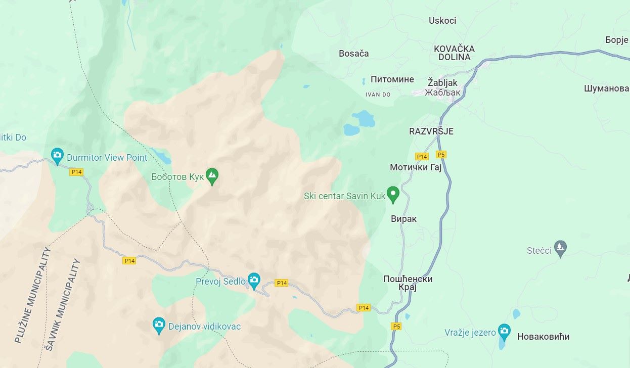
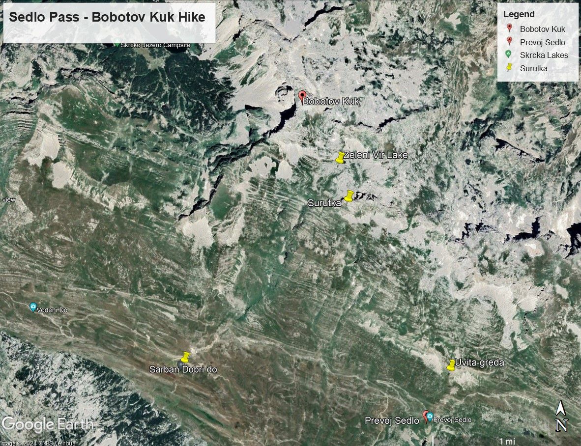
The start of the trail is from the asphalt regional road from the Sedlo pass, where there is a parking lot and a place to pay for the entrance fees to the National Park. The trail starts from the pass in a northerly direction, with a gentle ascent over grassy areas, along a clearly visible shepherd’s path.

It continues under the very rocks of Uvita greda, above the sipar, and in this way you reach a steep cut (which you have to overcome with the help of your hands!) which is the most serious obstacle on the part of the path from Sedlo to Zeleni vir.

Passing the cut, you enter a beautiful valley surrounded by the peaks of Uvita greda, Sljemena, Bandijerne, Zubac and Vjetrenih brda. The grandiose figure of Bobotov Kuk which dominates the entire area, appears in sight.

For the next 1.5 km, the path goes through grassy areas and without much effort reaches a valley called Surutka, where there is also a sign for a source of drinking water.

The next, easy section is from Surutka to Zeleni vir. From Surutka, with a gentle ascent of a few tens of meters, you come to a pass from which there is an excellent view of the peaks Sareni pasovi and Samar, as well as of Bobotov kuk itself.

From this pass, the path descends over 100 meters above sea level to Zeleni vir (2,028 meters above sea level), a lake which unfortunately is without water for most of the summer period.

The real ascent to Bobotov Kuk begins from Zeleni Vir!

The first section from Zeleni vir to Velika previja (2,351 masl) is characterized by a steep and strenuous ascent, straight up – initially over rock creep, stone surfaces, gullies and rocky cascades, and later on a steep grassy slope below Velika previja.

At Velika previja, the path joins the marked path that leads from Black Lake, from where it is also possible to hike to Bobotov Kuk peak.

By the way, the ascent to Bobotov Kuk is possible from three other directions: to the northeast – across Velika previja (already mentioned above) from Black Lake, northwest – from the direction of the Skrcka lake over Sareni pasovi (Samar) to Zeleni vir and further to the top and direction from Dobri do via Urdeni and Mlijecni dol to Zeleni vir, and then to the top on the same path.

The final ascent to Bobotov kuk begins from Velika previja, with an ascent of about 170 meters above sea level. That part of the path is a special whole, because it is a large stone boulder!

The path from Velika previja goes to the left under the rocks and soon emerges on another pass between the peak itself and the neighboring peak of Djevojka – “Soa Nebeska” which means “Altar of the Sky”. That place is a fantastic viewpoint on Skrka lakes and the Skrka valley!

Further, towards the top, a narrow path winds through very exposed cliffs to the very top. You should be extra careful on this part (mostly there is a cable) and it is the most dangerous part of the entire trail!

Under the very top, there is a memorial plaque to Danilo Jaukovic popular general of the Yugoslav army, national hero, founder and president of the Mountaineering and Skiing Association of Montenegro and a lover of Montenegrin mountains and mountain sports.

This is the man whose name you can read as well on the fountain in Gornja Bukovica or at the entrance to the Mrtvica Canyon next to the path in the rock that was made by the engineers of the former Yugoslav National Army in the 70s of the last century and which connects the village of Velje Duboko with other villages in the direction of the Moraca River Canyon. Few people know that the late General Jaukovic was the first to cross the canyon in order not to endanger the life a single one of the soldiers.

In memory of the great man, the General Danilo Jaukovic Memorial is held on Durmitor every year, with a climb to Bobotov Kuk and then an unforgettable gathering by the fire at Camp Dobri Do (Sarban).

The top is a rock of relatively small surface, covered with rocks crushed by lightning strikes. The view is extraordinary in all directions – you will take great photos!

To the south is a view of Bandijerna, Sljeme, Zubci, Sedlena Greda, Dobri do, Boljske Grede, Lojanik, Buruckovac, Ruzica, a little further to Vojnik, Moracke mountains, Sinjavina, etc.

To the west is a view of Djevojka, Sareni Pasovi, Ruzica, Buruckovac, Prutas, Maglic, Bioc, Volujak, etc.

The view to the north is Bezimeni vrh, Crvena greda, Stuoc, Planinica, Tara and Susica canyons, Ljubisnja, etc.

To the east is a view of the Zabljak plateau, Minin bogaz, Medjed, etc.

Tour summary:
The start of the trail: Sedlo pass 1,908 meters above sea level
Final destination: Bobotov kuk, peak 2.523 meters above sea level
Altitude difference: 615 m + 346 m during the ascent and descent along the path
Trail difficulty: Moderately difficult III
Track length: 5,6 km
Tour duration: 7 h
Physical fitness: High
The most favorable period of the year for climbing: in summer (there may be some snow even in this period of the year). Avoid rainy days with thunders.
Picture gallery Bobotov Kuk Hiking