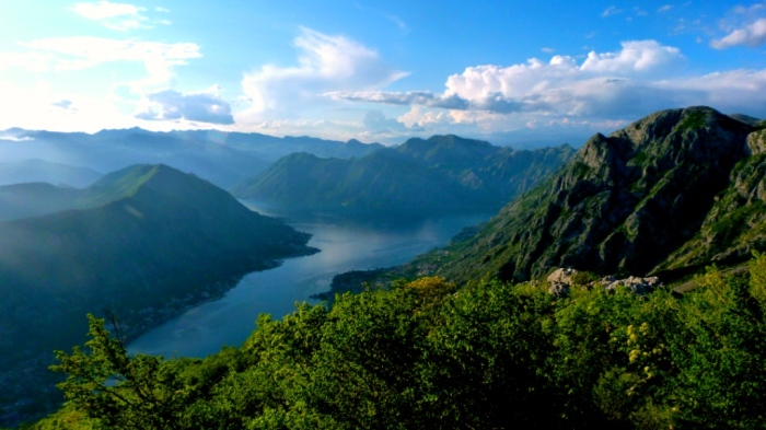
No matter whether you enter Boka by land or by sea – your experience will the same – Boka will fascinate you! It looks as if the mountains have cracked and let the sea in.
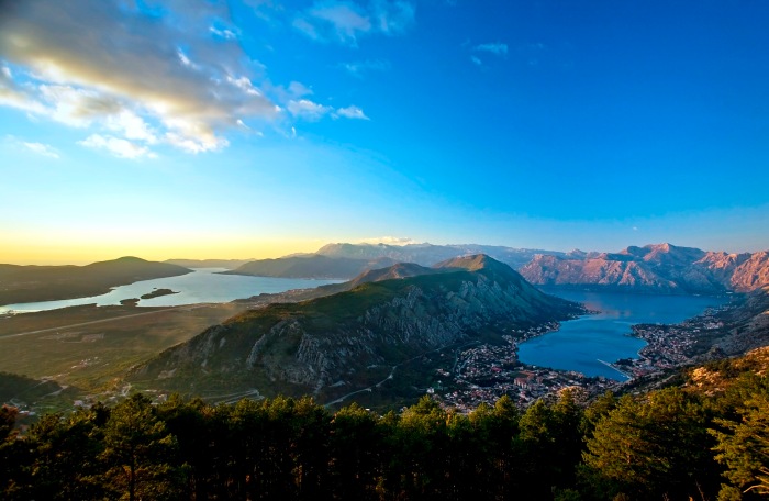
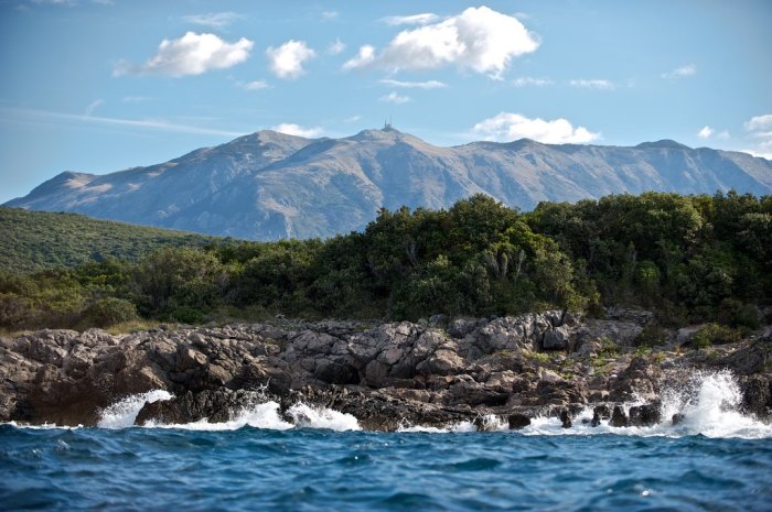
This is the southernmost fjord in Europe. The high mountains bend over the thin coastline thus protecting it from the severe climate from the north.
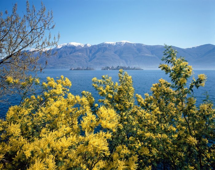
That is why Boka is an oasis of Mediterranean vegetation: agave, palm, mimosa, oleander, kiwi, pomegranate, medicinal herbs. When its peaks are covered with snow, the roses bloom in the foothills.
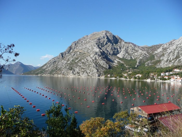
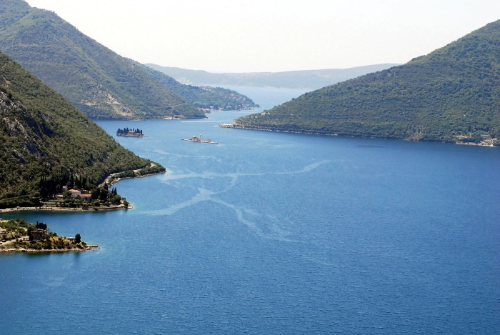
The most complex morphological entity is the Bay of Boka Kotorska, which consists of four enlargements interconnected by straits.
From direction of sea comes first the Bay of Herceg Novi and the Bay of Tivat, which are interconnected by the Strait of Kumbor.
Going inward, you enter the Bay of Risan and the Bay of Kotor, which are connected with the Bay of Tivat by a narrow maritime entity called Verige.
Verige Strait is only 350 meters wide and it is the narrowest strait in the Boka Bay. The name comes from unwilling event from 1624, when the pirates from North Africa sailed into the Bay and then ravaged the city of Perast. After that, the people of Perast and Kotor in order to ensure against sudden pirate incursions, in the narrowest part of the strait, have developed from one coast to the other shore an iron chain-Verige.
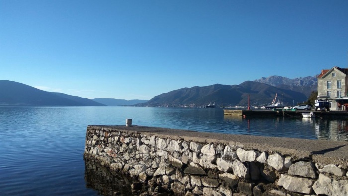
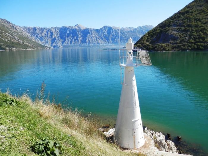
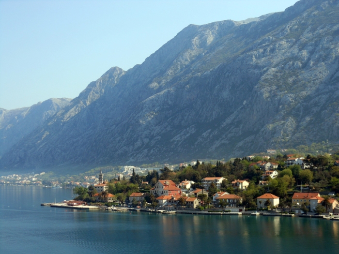
The Bay of Boka Kotorska is one of the most beautiful bays in the world. It is 30 km long by the medium line and 1.500 m wide at the entrance. The shore length is 106 km, and the sea surface 88 kmn.
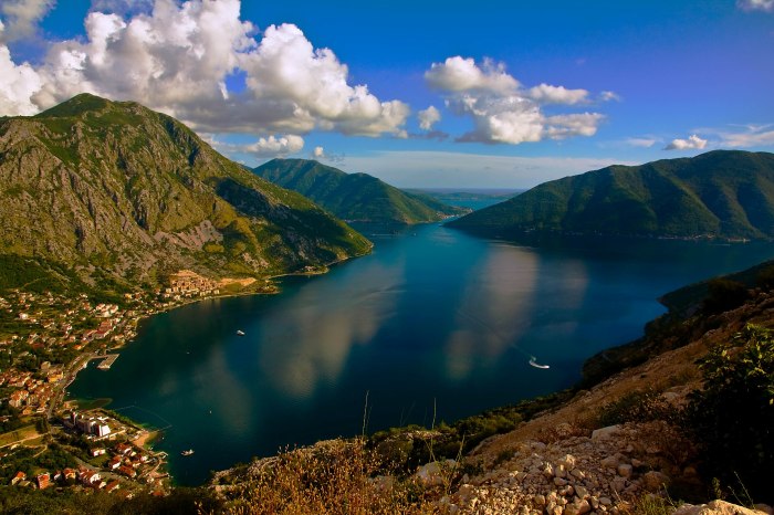
The border of the Bay of Boka Kotorska is represented by steep and high slopes of mountains Orjen, towards Krivosije, and Lovcen, towards Njegusi.
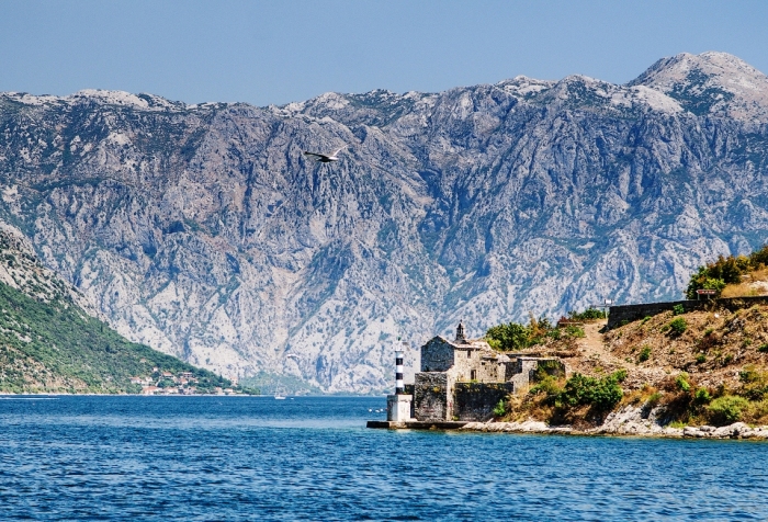
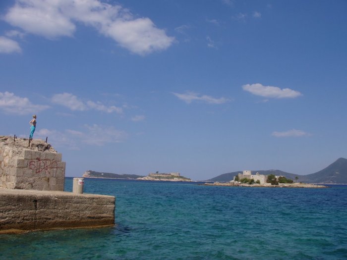
At the entrance to the Bay of Boka Kotorska from where beginning the territorial waters of Montenegro, natural border make Cape Ostra with the left side and the island-fortress Mamula and Lustica peninsula on the right side.
Island – Fortress ”Mamula„ was built on a small island, circular shape with a diameter of about 200 meters, surrounded by lots of agaves and with low vegetation. Mamula island is named after the Austrian general and governor of Dalmatia Lazar Mamula, which in the mid-nineteenth century is built a fortress Mamula.
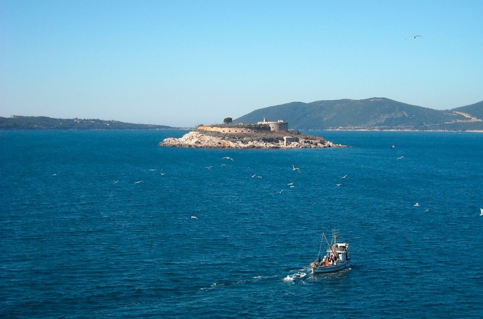
On the nautical charts this small island is called also Lastavica and together with the fortress Arza, which is about 1 nautical miles away from the fortress Mamula and fortress Prevlaka, on Cape Ostra (Croatia) was used as shield undesirable entrance to the Bay.
Lustica peninsula is located at the right of the entrance of the Bay of Kotor. It covers an area of 47 km2 and it is 13 km long. Its highest point is the hill Obosnik 582 m. It has an extraordinarily lavish, 35 km long coastline and there are some of the most attractive tourist sites and beaches are such as: Rose, Zanjice, Miriste, Arza and Dobrec. Lustica is famous for its olives, olive oil, prosciutto, cheese and the brandy.
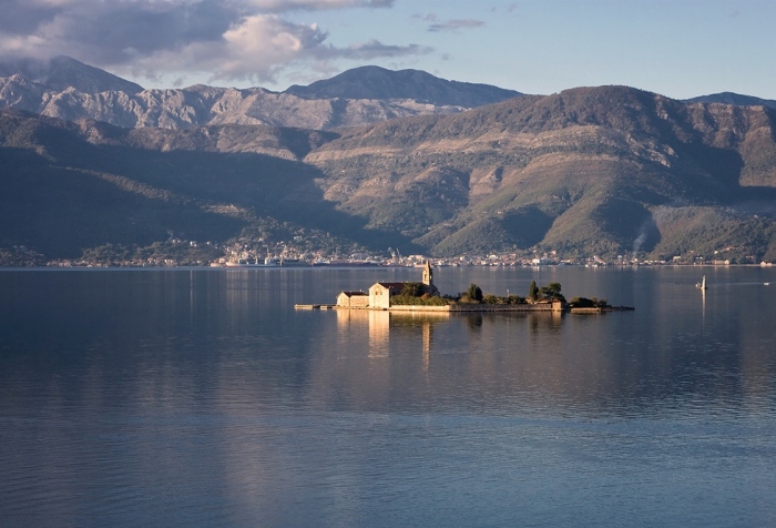
There are 7 islands in the Bay of Boka Kotorska, and the largest among them by surface is St. Marco (the old name: Stradioti), followed by the Island of Flowers, Mamula (Lastavica), St. George, Our Lady of the Rock (Lady of Skrpjela), Milosrda (Otok), while the tiniest island is the Little Lady.
Тhe small towns, as treasuries of history, art and beauty, are strung like pearls on its coastline.
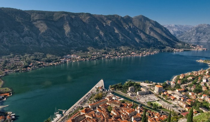
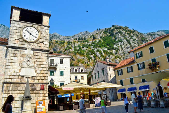
Kotor is the old coastal and cultural centre. For centuries, it has been a crossroads of commercial roads under the strong influence of Venice. It is protected by mountains with a strong defense structure built during the time of Byzantine Empire.
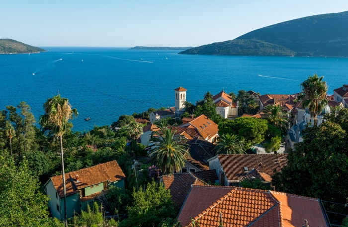
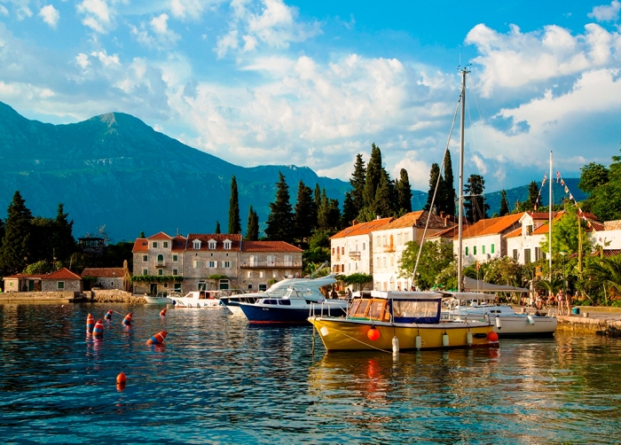
Dobrota is a small town in which numerous palaces of former sailors and shipowners are still preserved.
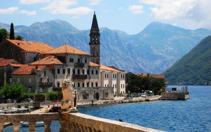
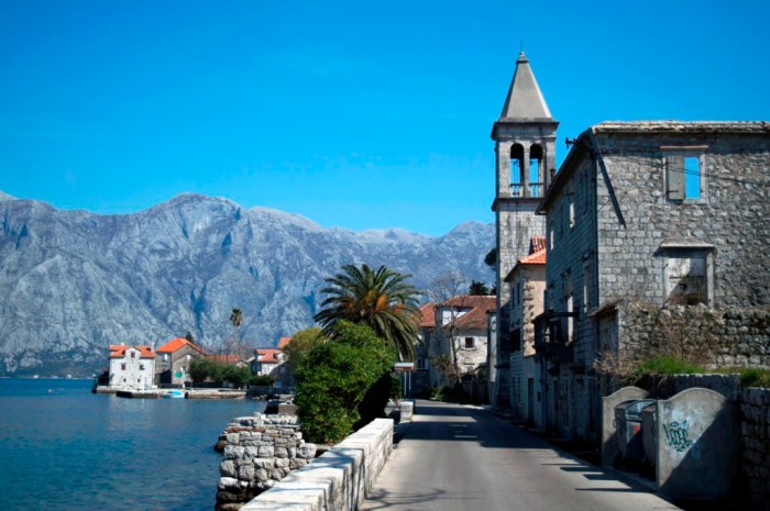
Perast is the homeland of many world-known sailors and a town whose destiny has always been related to the sea. By its lifestyle, it resembled Venice with which it had very lively trade and cultural links. There are a lot of remains of the old aristocratic palaces that now bear witness to its ancient splendor and richness.
Risan is famous for the remnants of the classical culture. The remains of a Roman patrician’s villa with mosaic floors as beautiful as those made in Roman period can be found here.
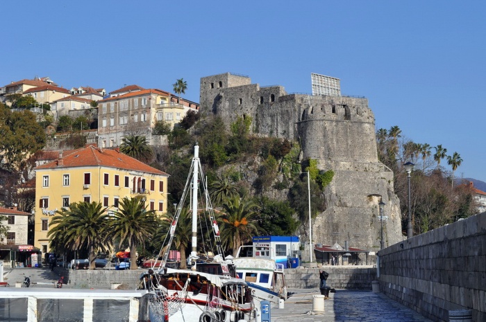
Herceg Novi is a town situated at the end of the bay. Its appearance is an illustration of its turbulent history. The town is a fine combination of romantic, Byzantine and oriental styles interweaved in the Mediterranean appearance of this town. Today, Herceg Novi is the town of flowers with all its windows faced toward the sun and the sea. It is one of the warmest towns on the Adriatic coast.
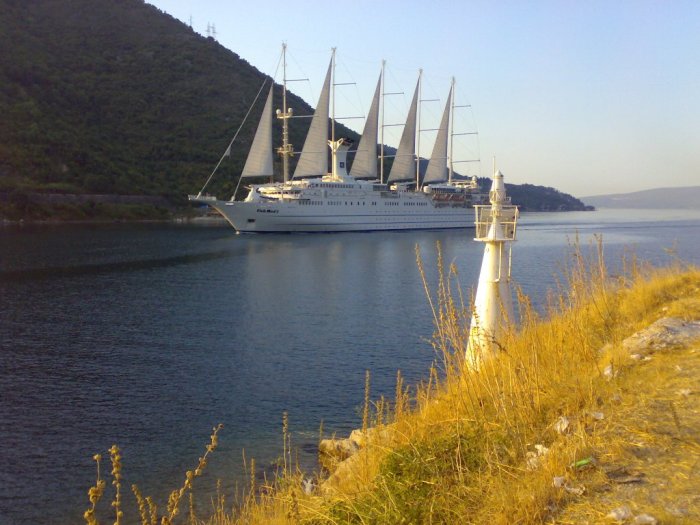
The towns in the Bay are interconnected by road and maritime communications. They also make a part of the entire attractiveness of the Bay. The maritime communications are maintained through local and line navigation.
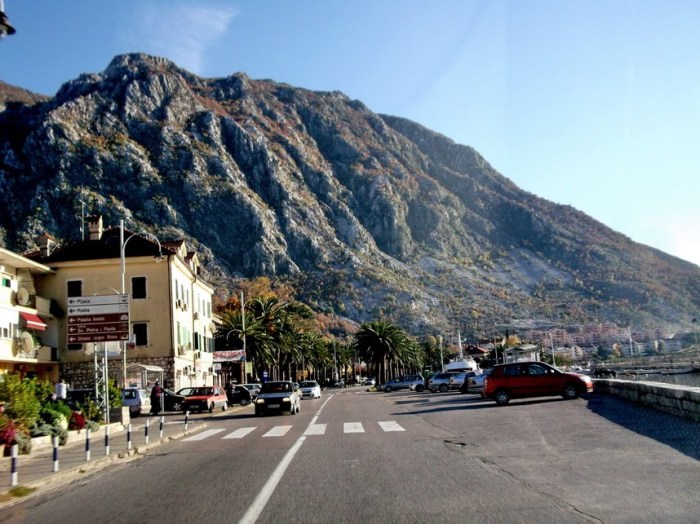
The key role in the road communications has the Adriatic Road, which frames the Bay linking the shore towns.
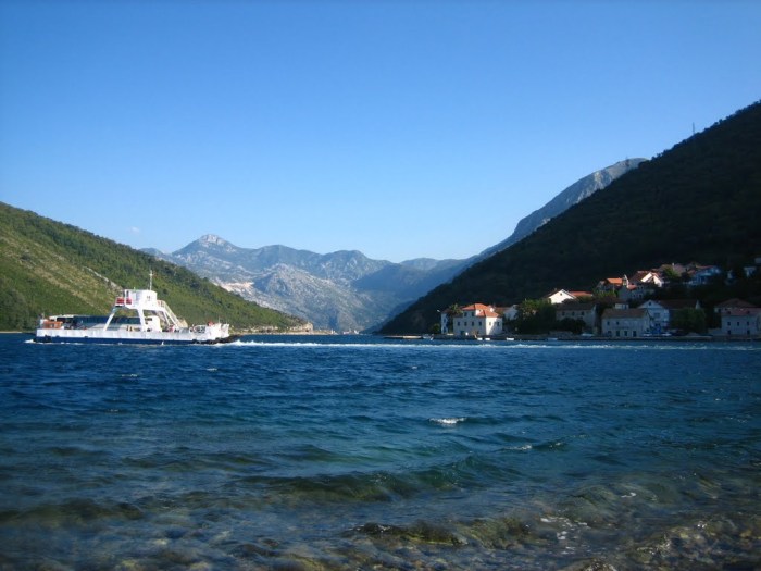
The narrowest part of the Bay is the Strait of Verige, where the construction of a bridge is projected, but it has not been realised so far, so that in this part a ferry navigates between Lepetani and Kamenari, whereby the length of the Adriatic Road is considerably cut down.
The mutual connection and unity of natural and anthropogenic motives make the Adriatic Sea the unique landscape entity, not only in the European Mediterranean, but also generally in the world. The warm sea, a pleasant climate, the Mediterranean vegetation, the specific animal world, the archaeology sites, small and big towns are the unique richness of our sea and Riviera.